Checked
Saskatoon parks directory
Saskatoon, Saskatchewan, Canada
Find Saskatoon, Saskatchewan parks and open spaces, with individual descriptions, recorded facilities, photos where verified and Google Maps.
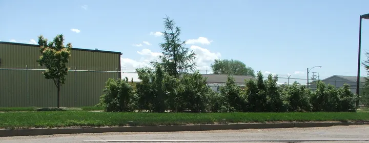
Key information
Browse 307 park and open-space sections for Saskatoon. Search a name, street or recorded feature, then open that place’s map. The source scope and any missing information are explained below.
On this page
What this directory covers
| Detail | Coverage |
|---|---|
| Individual sections | 307 |
| Source scope | Every record in the official City of Saskatoon Parks GIS layer (303 polygons) and every place marker in the city-linked park amenities map (272 markers). Matching names and map points within recorded park land are grouped without dropping IDs. Includes future-construction records, unnamed land and nearby Meewasin destinations explicitly identified by the city map. |
| Coverage limits | All entries in the stated source scope are included. This does not establish current public access. |
Every record in the official City of Saskatoon Parks GIS layer (303 polygons) and every place marker in the city-linked park amenities map (272 markers). Matching names and map points within recorded park land are grouped without dropping IDs. Includes future-construction records, unnamed land and nearby Meewasin destinations explicitly identified by the city map.
Recorded facilities can be seasonal, closed or out of service. A blank field means not confirmed. A map point may mark park land rather than a public or accessible entrance.
Sources: Saskatoon official park inventory · Saskatoon park etiquette · Saskatoon park locations and amenities
Find a park
Search the recorded names, streets, descriptions and facilities. Each result has its own section and map links. Only the places on the current page are downloaded.
Some pins mark park land rather than an entrance. Official park pages have current visiting details.
281 to 300 of 307 places
Unnamed park (city asset 5860)
Proposed, Saskatoon, Saskatchewan, Canada
Unnamed park (city asset 5860) is recorded in Saskatoon's official park land map. Its recorded location is Proposed.
The land record identifies the park boundary. It does not provide a full amenity list or confirm current public access.
- City park ID
- 5860
- Mapped parcels
- 1
Sources: Saskatoon official park inventory
Unnamed park (city asset 5900)
Proposed, Saskatoon, Saskatchewan, Canada
Unnamed park (city asset 5900) is recorded in Saskatoon's official park land map. Its recorded location is Proposed.
The land record identifies the park boundary. It does not provide a full amenity list or confirm current public access.
- City park ID
- 5900
- Mapped parcels
- 1
Sources: Saskatoon official park inventory
Unnamed park (city asset 5930)
Proposed, Saskatoon, Saskatchewan, Canada
Unnamed park (city asset 5930) is recorded in Saskatoon's official park land map. Its recorded location is Proposed.
The land record identifies the park boundary. It does not provide a full amenity list or confirm current public access.
- City park ID
- 5930
- Mapped parcels
- 1
Sources: Saskatoon official park inventory
Unnamed park (city asset 6010)
Proposed, Saskatoon, Saskatchewan, Canada
Unnamed park (city asset 6010) is recorded in Saskatoon's official park land map. Its recorded location is Proposed.
The land record identifies the park boundary. It does not provide a full amenity list or confirm current public access.
- City park ID
- 6010
- Mapped parcels
- 1
Sources: Saskatoon official park inventory
Unnamed park (city asset 6130)
Proposed, Saskatoon, Saskatchewan, Canada
Unnamed park (city asset 6130) is recorded in Saskatoon's official park land map. Its recorded location is Proposed.
The land record identifies the park boundary. It does not provide a full amenity list or confirm current public access.
- City park ID
- 6130
- Mapped parcels
- 1
Sources: Saskatoon official park inventory
Unnamed park (city asset 6290)
415 Spadina Cres E, Saskatoon, Saskatchewan, Canada
Unnamed park (city asset 6290) is recorded in Saskatoon's official park land map. Its recorded location is 415 Spadina Cres E.
The land record identifies the park boundary. It does not provide a full amenity list or confirm current public access.
- City park ID
- 6290
- Mapped parcels
- 1
Sources: Saskatoon official park inventory
Varley
302 Bennion Crescent, Saskatoon area, Saskatchewan, Canada
Varley is recorded in Saskatoon's official park land map. Its recorded location is 302 Bennion Cres.
For Varley Park, the city's park map lists Walking Path.
- City park ID
- 4810
- Mapped parcels
- 1
- City map address
- 302 Bennion Crescent
- Listed amenities (Varley Park)
- Walking Path
Sources: Saskatoon official park inventory · City of Saskatoon park locations and amenities map
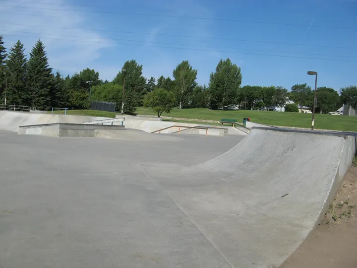
Victoria
810 Spadina Cres W, Saskatoon area, Saskatchewan, Canada
Victoria is recorded in Saskatoon's official park land map. Its recorded location is 810 Spadina Cres W.
For Victoria Park, the city's park map lists Community Garden, Parking, Riversdale Pool, Rowing Club, Skateboard, Tennis Club, Walking Path.
For Victoria Park, the city's park map lists Community Garden, Parking, Riversdale Pool, Rowing Club, Skateboard, Tennis Club, Walking Path.
- City park ID
- 2430
- Mapped parcels
- 1
- City map address
- 810 Spadina Cres W
- Listed amenities (Victoria Park)
- Community Garden, Parking, Riversdale Pool, Rowing Club, Skateboard, Tennis Club, Walking Path
- City map address (Victoria Park)
- 810 Spadina Cres W
- Listed amenities (Victoria Park)
- Community Garden, Parking, Riversdale Pool, Rowing Club, Skateboard, Tennis Club, Walking Path
Sources: Saskatoon official park inventory · City of Saskatoon park locations and amenities map
Walecke
327 Stilling Manor, Saskatoon, Saskatchewan, Canada
Walecke is recorded in Saskatoon's official park land map. Its recorded location is 327 Stilling Manor.
The land record identifies the park boundary. It does not provide a full amenity list or confirm current public access.
- City park ID
- 5730
- Mapped parcels
- 1
Sources: Saskatoon official park inventory
Wallace
903 Stensrud Road, Saskatoon area, Saskatchewan, Canada
Wallace is recorded in Saskatoon's official park land map. Its recorded location is 903 Stensrud Rd.
For Wallace Park, the city's park map lists Ball Diamond, Play Unit, Soccer, Spray Pool, Toboggan, Walking Path.
- City park ID
- 4650
- Mapped parcels
- 1
- City map address
- 903 Stensrud Road
- Listed amenities (Wallace Park)
- Ball Diamond, Play Unit, Soccer, Spray Pool, Toboggan, Walking Path
Sources: Saskatoon official park inventory · City of Saskatoon park locations and amenities map
Walter Wood
403 Lewin Way, Saskatoon area, Saskatchewan, Canada
Walter Wood is recorded in Saskatoon's official park land map. Its recorded location is 403 Lewin Way.
For Walter Wood Park, the city's park map lists Walking Path.
- City park ID
- 3790
- Mapped parcels
- 1
- City map address
- 403 Lewin Way
- Listed amenities (Walter Wood Park)
- Walking Path
Sources: Saskatoon official park inventory · City of Saskatoon park locations and amenities map
wāwāhtēwa
105 Henry Dayday Rd, Saskatoon, Saskatchewan, Canada
wāwāhtēwa is recorded in Saskatoon's official park land map. Its recorded location is 105 Henry Dayday Rd.
The land record identifies the park boundary. It does not provide a full amenity list or confirm current public access.
- City park ID
- 6280
- Mapped parcels
- 1
Sources: Saskatoon official park inventory
WE Graham
602 Dufferin Avenue, Saskatoon area, Saskatchewan, Canada
WE Graham is recorded in Saskatoon's official park land map. Its recorded location is 602 Dufferin Ave.
For W.E. Graham Park, the city's park map lists Soccer Field, Play Structure, Picnic Site.
- City park ID
- 3830
- Mapped parcels
- 1
- City map address
- 602 Dufferin Avenue
- Listed amenities (W.E. Graham Park)
- Soccer Field, Play Structure, Picnic Site
Sources: Saskatoon official park inventory · City of Saskatoon park locations and amenities map
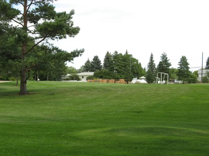
Weaver
515 Adelaide Street, Saskatoon area, Saskatchewan, Canada
Weaver is recorded in Saskatoon's official park land map. Its recorded location is 515 Adelaide St.
For Weaver Park, the city's park map lists Basketball, Play Unit, Soccer, Walking Path.
- City park ID
- 3590
- Mapped parcels
- 1
- City map address
- 515 Adelaide Street
- Listed amenities (Weaver Park)
- Basketball, Play Unit, Soccer, Walking Path
Sources: Saskatoon official park inventory · City of Saskatoon park locations and amenities map
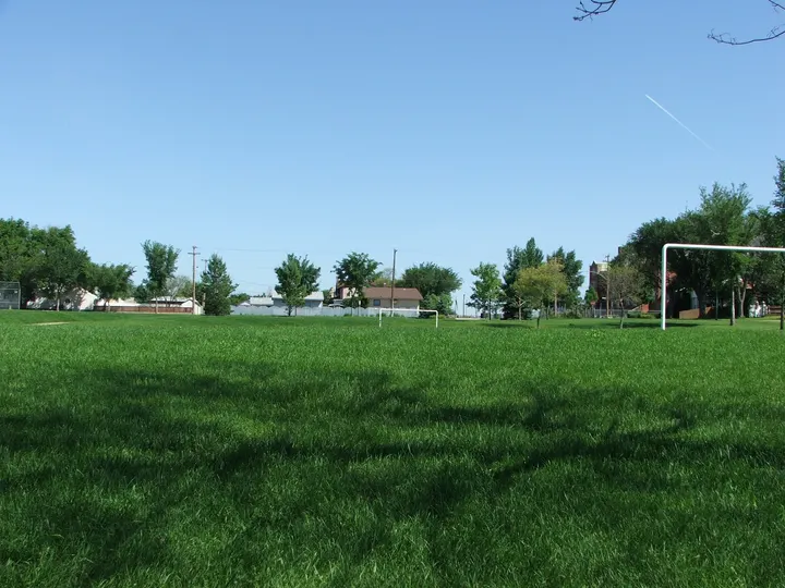
Westmount
310 Avenue L North, Saskatoon area, Saskatchewan, Canada
Westmount is recorded in Saskatoon's official park land map. Its recorded location is 310 Ave L N.
For Westmount Park, the city's park map lists Ball Diamond, Basketball, Paddling Pool, Play Unit, Soccer, Walking Path.
- City park ID
- 2440
- Mapped parcels
- 1
- City map address
- 310 Avenue L North
- Listed amenities (Westmount Park)
- Ball Diamond, Basketball, Paddling Pool, Play Unit, Soccer, Walking Path
Sources: Saskatoon official park inventory · City of Saskatoon park locations and amenities map
Wiggins
1615 Wiggins Avenue, Saskatoon area, Saskatchewan, Canada
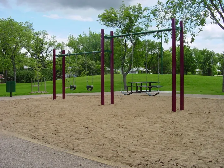
Wiggins is recorded in Saskatoon's official park land map. Its recorded location is 1615 Wiggins Ave.
For Wiggins Park, the city's park map lists Picnic Site, Play Unit, Toboggan.
- City park ID
- 3580
- Mapped parcels
- 1
- City map address
- 1615 Wiggins Avenue
- Listed amenities (Wiggins Park)
- Picnic Site, Play Unit, Toboggan
Sources: Saskatoon official park inventory · City of Saskatoon park locations and amenities map
Wildwood
315 Rosedale Rd, Saskatoon, Saskatchewan, Canada
Wildwood is recorded in Saskatoon's official park land map. Its recorded location is 315 Rosedale Rd.
The land record identifies the park boundary. It does not provide a full amenity list or confirm current public access.
- City park ID
- 4270
- Mapped parcels
- 1
Sources: Saskatoon official park inventory
Wildwood
315 Rosedale Road, Saskatoon area, Saskatchewan, Canada
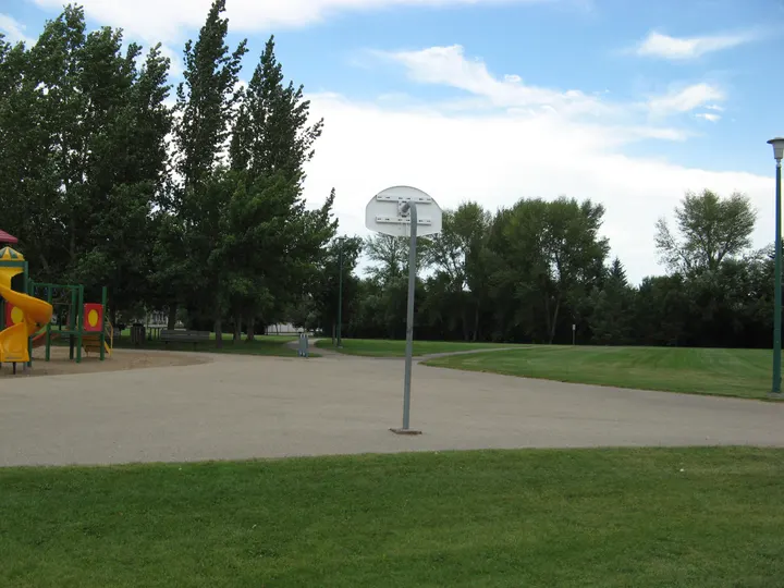
Wildwood is recorded in Saskatoon's official park land map. Its recorded location is 4100 8th St E.
For Wildwood Park, the city's park map lists Ball Diamond, Basketball, Paddling Pool, Play Unit, Rink, Soccer, Walking Path.
- City park ID
- 5060
- Mapped parcels
- 1
- City map address
- 315 Rosedale Road
- Listed amenities (Wildwood Park)
- Ball Diamond, Basketball, Paddling Pool, Play Unit, Rink, Soccer, Walking Path
Sources: Saskatoon official park inventory · City of Saskatoon park locations and amenities map
William A Reid
319 Pendygrasse Road, Saskatoon area, Saskatchewan, Canada
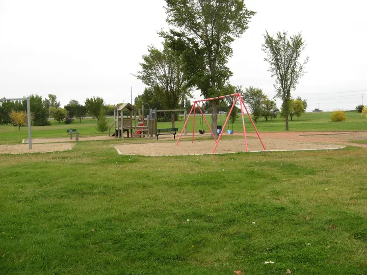
William A Reid is recorded in Saskatoon's official park land map. Its recorded location is 319 Pendygrasse Rd.
For William A. Reid Park, the city's park map lists Ball Diamonds, Pavillion with Seasonal Washrooms, Picnic Site, Walking Paths.
- City park ID
- 2450
- Mapped parcels
- 1
- City map address
- 319 Pendygrasse Road
- Listed amenities (William A. Reid Park)
- Ball Diamonds, Pavillion with Seasonal Washrooms, Picnic Site, Walking Paths
Sources: Saskatoon official park inventory · City of Saskatoon park locations and amenities map
William Anderson
202 Dickson Crescent, Saskatoon area, Saskatchewan, Canada
William Anderson is recorded in Saskatoon's official park land map. Its recorded location is 1040 Stonebridge Common.
For William Anderson Park, the city's park map lists Walking Path.
- City park ID
- 3780
- Mapped parcels
- 1
- City map address
- 202 Dickson Crescent
- Listed amenities (William Anderson Park)
- Walking Path
Sources: Saskatoon official park inventory · City of Saskatoon park locations and amenities map
Planning your park visit
Which parks are covered by this directory?
Every GIS park-land record and every marker in the city-linked amenities map is included. It also retains unnamed land, future-construction sites and nearby Meewasin destinations.
Do map points identify park entrances?
No. Each point is an approximate centre of recorded park land. The source does not map accessible visitor entrances.
When do Saskatoon parks open and close?
City parks open from 5 a.m. until midnight. Riverbank parks are open 24 hours.
Source: Saskatoon park etiquette
Can dogs be off leash in parks?
Only in designated dog parks. Elsewhere, keep them leashed and pick up their waste.
Source: Saskatoon park etiquette
Can I smoke or vape in a city park?
No. City-owned outdoor public places, including parks, trails and playgrounds, prohibit smoking and vaping.
Source: Saskatoon park etiquette
How should cyclists share park trails?
Keep right, pass on the left, use a warning bell and ride at a safe speed. Pedestrians have priority.
Source: Saskatoon park etiquette
Can I camp overnight in a park?
No. Camping is not permitted in Saskatoon parks.
Source: Saskatoon park etiquette
Can I use a metal detector or dig in a park?
Surface detection is allowed. Digging is prohibited because holes can injure park users.
Source: Saskatoon park etiquette
Which parks have naturalized landscapes?
The city lists Lakewood, Heritage, Mark Thompson, Gabriel Dumont, Patricia Roe, Hyde, Donna Birkmaier, Sanatorium Site, kīwētin Greenway and Tatanka.
Who handles park questions?
Call the city Parks team at 306-975-3300. Give the park name and the service or access detail you need.
Official park information
Sources: Saskatoon official park inventory · Saskatoon park etiquette · Saskatoon park locations and amenities